A large-scale map is spread out on 90-year-old Bill Golding’s kitchen table. Beside him sits Sarah Sharp, a fellow member of the Friends of the Great South West Walk (GSWW) volunteer group, a not-for-profit organisation that maintains Victoria’s GSWW tracks. We’re all transfixed by the map. I listen carefully as Bill and Sarah describe the main sections of the track and point out must-see sites. Sarah encourages Bill to tell the story of how the track was created.
“I grew up in Mildura and was a teacher all my working life,” says Bill. “In early 1978, I moved to Portland with my wife after I won the headmaster role at Portland High School. Initially, I had no intention of coming here and had no particular interest in the area. But, boy, were my eyes about to be opened.”
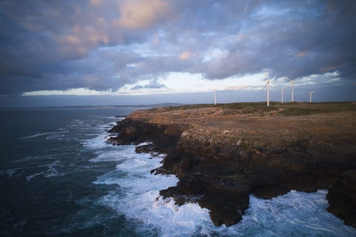
Bill explains that the idea for the GSWW was first hatched in February 1980 by the late Alan (Sam) Bruton, chief district ranger of the then Department of Conservation’s National Parks division. Sam had been examining a collection of local maps and noticed a rich band of public land looping from Portland all the way to the South Australian border. The encompassing area included four diverse environments: the forests of the Cobboboonee National Park; the tranquil Glenelg River and Lower Glenelg National Park; the remote beaches of Discovery Bay; and the rugged cliffs of Cape Bridgewater and Cape Nelson.
At the time, Bill had just led a school project to construct the Sea Cliff Nature Walk at Cape Nelson. Sam paid a visit to Bill’s office on the following Monday morning and unrolled the rough plan for a 200km-long hike. “Here’s your next job,” he said to Bill. “Why don’t we build a track all the way around?”
Bill was excited by the idea and raised it with the school’s deputy principal, Don Chalmers.
“I was always going off on tangents, but I was fortunate to have Don who kept me under control,” says Bill, laughing. “He’d stop me from doing stupid things all the time. But he was enthusiastic about the track concept, so we went for it.”
Under the leadership of its chairman, Graeme Hume, the school council enthusiastically decided to integrate the creation of the long-distance walk into the school curriculum. A steering committee was formed to drive the project. The committee consisted of land managers, government agencies, the local government council and school representatives.
Most of the track was completed in 1981-82 by Portland High School’s Year 10 students, who had the choice to work on the project for their week-long work experience placement. After four years of planning and construction, it was officially opened on 13 November 1983. Responsibility for the track was transferred in 1984 from the high school to a new committee: Friends of the Great South West Walk. This group has further developed and maintained the walking route ever since.
Soon after the 1984 transfer, Friends of the GSWW focused on improving facilities, including re-routing the track from dirt roads onto walking paths. In 2010 Parks Victoria obtained funding to upgrade signage, shelters, toilets and water tanks.
Friends of the GSWW currently includes 120 members, eight committee people and two representatives from Parks Victoria, plus 25 volunteer track crew, who carry out maintenance work every Tuesday, Thursday and Saturday. They work tirelessly to keep the track in good condition – mowing, revegetating, clearing fallen trees, cutting back shrubs that encroach on the track and building steps and bridges.
Bill’s face lights up and his eyes sparkle as he recalls the walk’s history. He is proud and passionate, but also grateful to have been part of such an amazing community project.
“You start me talking about this, and you’ll have to hit me on the head with an axe to shut me up,” he says. “Spare a thought for my poor wife. It’s consumed our lives for 43 years now. Morning, noon and night.”
The following morning, I pick up Bill and we drive to Cut Out Camp to walk one of his favourite stretches of the track, within Cobboboonee NP. As soon as he steps out of the car, I can see that the forest has a profound effect on him. His smile broadens from ear to ear and his jaw drops as he looks skyward towards the canopy of his beloved messmates.
Approaching his 91st year, Bill is living proof that spending time in nature can positively impact health and wellbeing. He’s in good shape, mentally and physically.
As we walk deeper into the forest, I watch in awe as Bill totally immerses himself in the surrounding environment. He’s calm and content, but his senses are heightened. He gazes dreamily at the towering trees, yet he also notices the small things. He bends down to point out a tiny budding orchid and he stops to listen to the birds. “That’s a bronzewing pigeon up there and there’s some white cockatoos over there,” he says, pointing. Along the way, he continually clears the track, picking up and throwing away any branches that may hinder a walker. Further on, he climbs over a large fallen tree that is strewn across the path. After a short walk through the forest to Ralphs Bridge and back, we sit down for lunch at Cut Out Camp. Forever generous, Bill empties his backpack and hands out sandwiches, fruit cake and tea.
Later, as we walk back to the car, Bill recites a couple of sentences from one of his recent diary entries. “The full light of a glorious morning falls on this sublime forest. Every step is one of gratitude,” he says. The words are poetic, thoughtful, appreciative and inspiring. It sums up Bill perfectly.

Leaving the Cobboboonee forest, walkers enter Lower Glenelg National Park and the Glenelg River valley. The largest river in south-western Victoria, the Glenelg River is known by the Gunditjmara people as Bocara. From its headwaters west of the Grampians the river runs for about 350km to Discovery Bay, near Nelson.
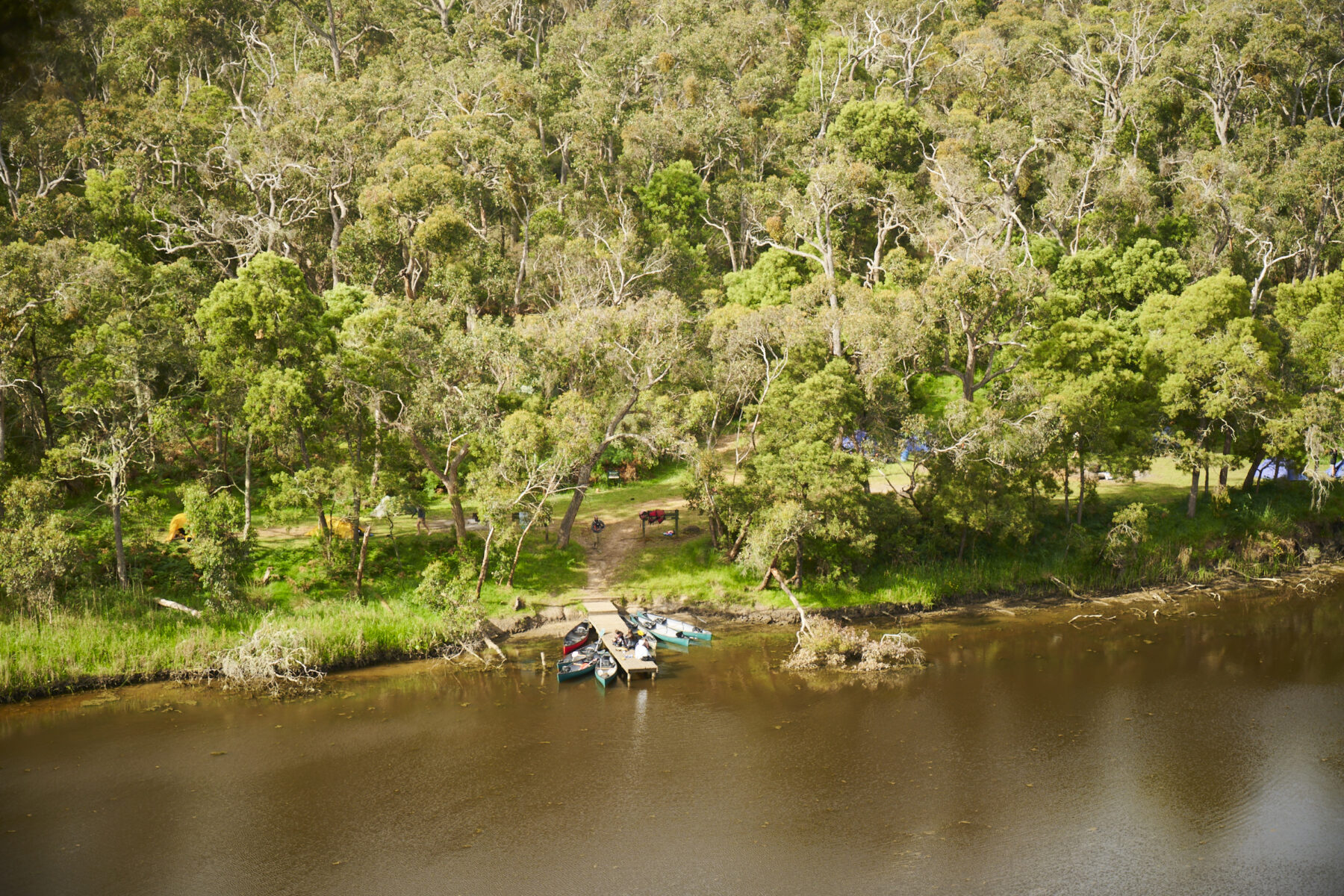
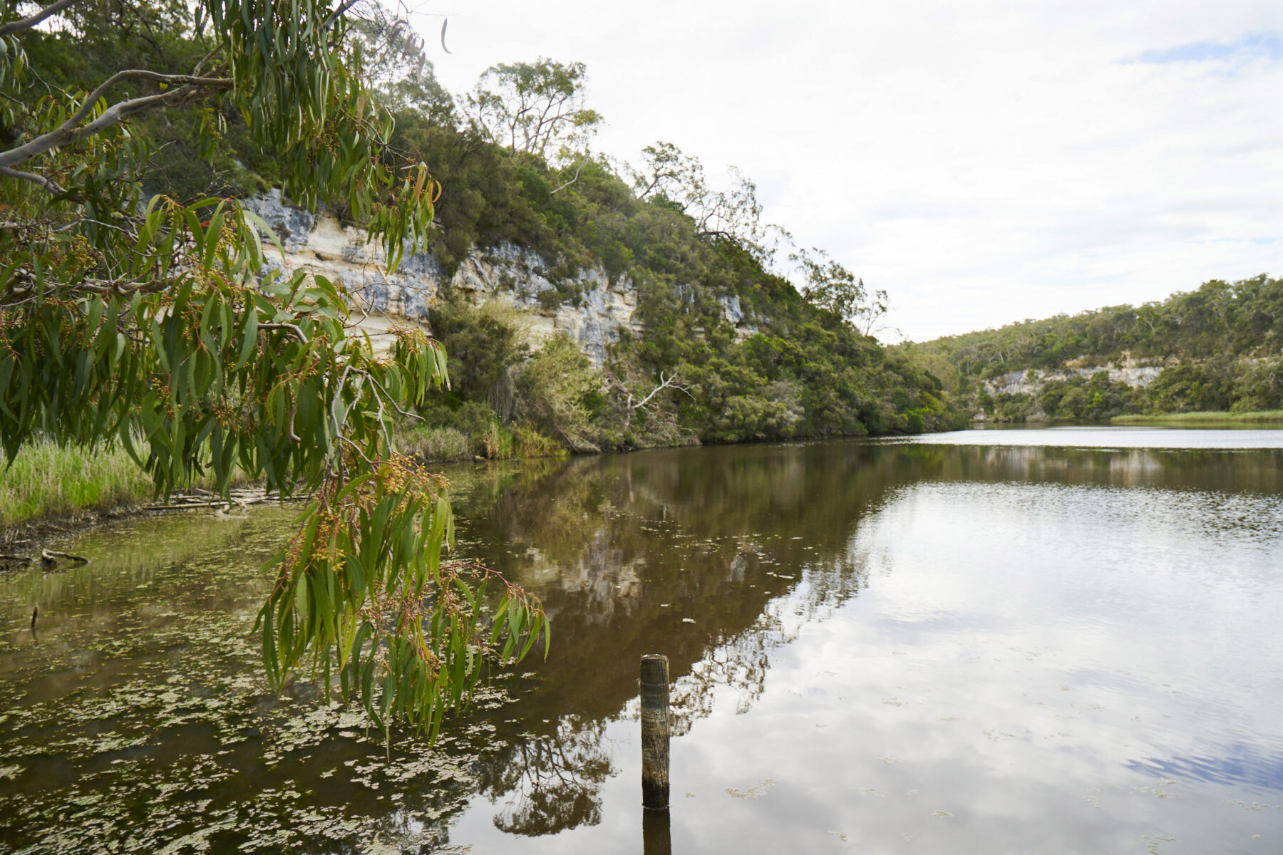
This section of the GSWW has a number of scenic riverside campsites, picnic areas and canoe landings used by hikers, anglers and paddlers. Nestled on the riverbank near soaring limestone cliffs, Pattersons Camping Area is perhaps the most picturesque campsite on the entire walk. Its shelter faces a grove of tussock grass and river red gums lining the water’s edge. Soaring limestone cliffs can be seen to the left on a wide bend in the river. Some 200m downstream is Pattersons Canoe Camping Area, an equally beautiful spot with a toilet and water tank, a picnic table, three old huts and a picturesque jetty beside the gnarly river red gums.
The GSWW gently rises and falls along the river course with breathtaking viewpoints scattered along the cliff tops. About 700 native plant species and more than 50 varieties of orchid are found in Lower Glenelg NP. Further downstream, the vegetation becomes distinctly coastal, with species such as coast beard-heath, coast sword-sedge, moonah and messmate, among others.
At Nelson, we are introduced to local fisher Gordon Jeffrey, who kindly invites us onto his boat for a private outing on the Glenelg River. We cruise upstream, passing boatsheds that have been converted into waterfront holiday homes.
Gordon was born nearby in Mount Gambier and has been fishing on the river since he was a child. He moved to Nelson in 2017 after he retired and spends about five days a week on the water. A self-proclaimed “mad fisherman”, Gordon now creates and sells handcrafted fly lures and teaches fly-fishing. His love and passion for the river goes far beyond wetting a line.
“Fly-fishing and being on the river has really helped me through some hard times,” he says. “The river has a deep therapeutic impact on me. It’s not just about catching fish. I can go angling for four or five hours, casting non-stop, and catch nothing. But I always have a great time and I always go home happy.”
Gordon slows the boat to a halt next to one of the towering cliffs and looks up at the sky. “The weather moves quickly here, and I love watching the changing shapes and movement of the clouds,” he says. “It’s beautiful when the sunlight hits the cliffs; it really highlights the different colours in the rock. It’s very relaxing on the water.”
From Nelson, the GSWW loops around and heads back towards Portland along the coast. In contrast to the more sheltered Glenelg River, Discovery Bay is truly wild and exposed; rips lurk beneath the surface of the roiling waves. This section features a far-reaching expanse of white beaches and rolling dunes. Indigenous middens containing a montage of broken shells, bones, flints, stone chips and ash can be found in the dunes near Nobles Rocks and McEacherns Rocks. These protected midden sites are culturally significant and should not be touched or disturbed.
This coastal region also features Oxbow Lake, the Glenelg River estuary, Long Swamp, Lake Mombeong, Swan Lake, Malseed Lake and Bridgewater Lakes. These Ramsar-listed waterways are home to a variety of migratory birds.
Near the Nobles Rocks car park, two self-sufficient hikers, Greg Hunt and Carolyn Layton from Melbourne, are making their way along the beach. They are completing the entire GSWW loop and are just past halfway through their journey. After a long beach walk, following a rest day in Nelson, they are now about to start the inland route to their campsite for the night at Lake Mombeong.
“We enjoy long-distance hiking and don’t mind roughing it,” says Carolyn. “We are both 72 and we are feeling pretty good that we are still able to do this.” The couple had originally planned to walk the Bibbulmun Track in Western Australia but COVID travel restrictions meant they had to reschedule. They researched many alternatives and finally settled on the GSWW. “We really appreciate the shelters, camping facilities and all the work that goes into the track,” says Greg. “The volunteers do a hell of a job. They are so generous and passionate, and we feel grateful that they care so much about their region and that they are willing to share it with us.”
Near Swan Lake, walkers are presented with a choice of routes: they can continue along the beach and onto the cliffs of Cape Bridgewater or extend the walk by a day and head inland over Mt Richmond to Tarragal Camping Area. Mt Richmond is an extinct volcano covered with a layer of ancient sand blown inland from Discovery Bay. Surrounded by low, flat land, it features spectacular spring wildflowers, abundant wildlife and unspoilt bushland.
On the eastern side of Bridgewater Lakes, walkers can take a short side-trip to Tarragal Caves. These large, arched caves are set in a high limestone cliff, providing good views over the lakes. The site is important to the Gunditjmara people, with archaeologists locating shell-midden deposits and earth ovens more than 11,000 years old.
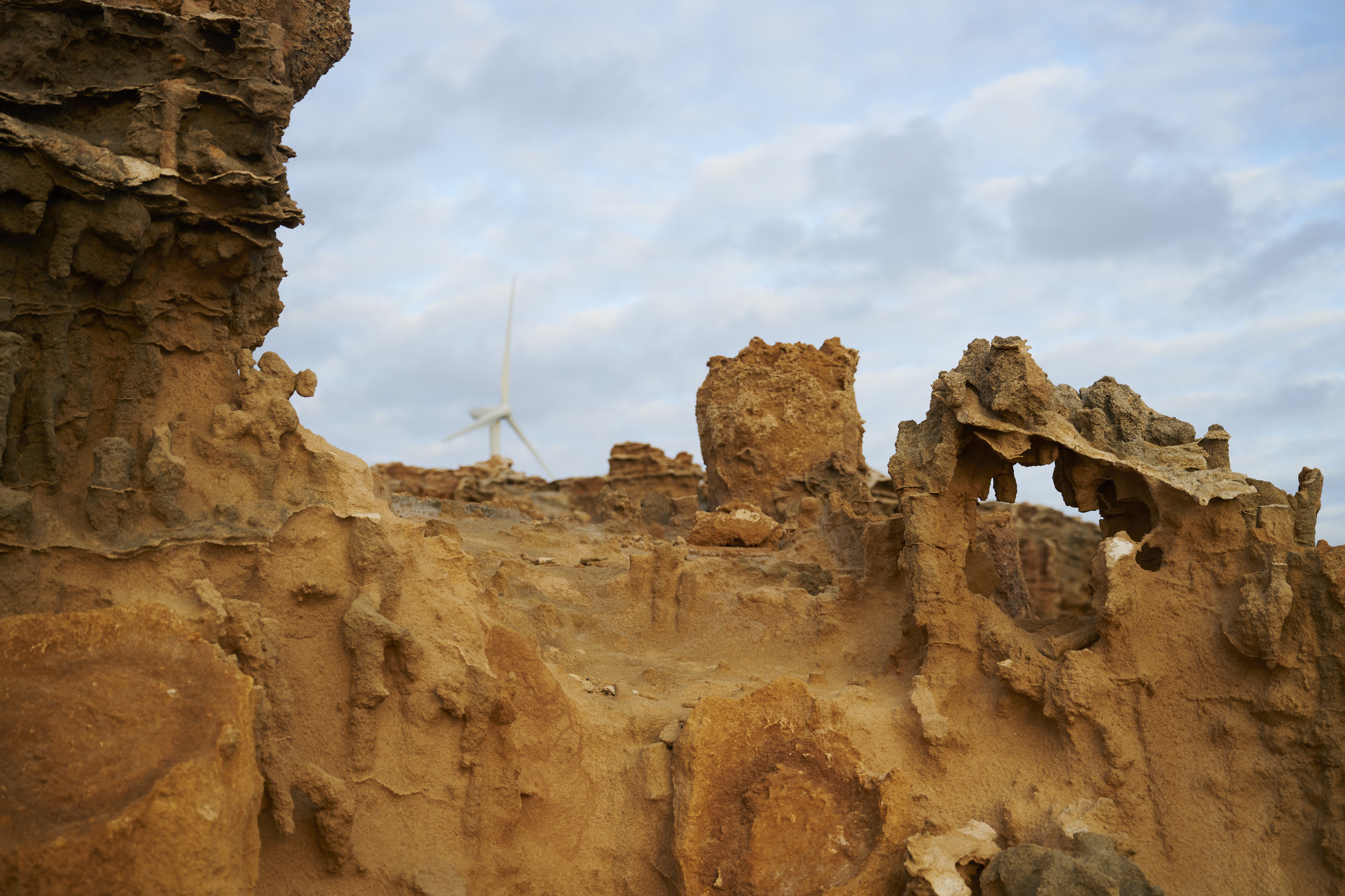
Bidding farewell to the inland forests and extensive beach walks, walkers enter the capes and cliffs region. From Cape Bridgewater to Portland, it’s mostly weather-beaten sea cliffs and rugged capes with scattered sandy beaches along the way. Cape Bridgewater was once a volcanic island. Over time, hardened dunes linked the island to the mainland when they transformed into a sandy limestone called calcarenite.
A good example of this geology and volcanic activity can be seen in the area encompassing the Blowholes and the Petrified Forest. The rocky platforms at Cape Bridgewater support colonies of two seal species: Australian fur seals and long-nosed fur seals. Lookouts are dotted along the cliffs, providing a good chance to spot seals below. Further on, the route runs alongside Bridgewater Bay, a wind-swept sandy cove that stretches in a perfect crescent around the rim of the huge ancient volcano crater.
At Cape Nelson, I meet Sarah Sharp again to walk the eastern section along Bridgewater Bay. She has a deep-rooted family connection to this area. “The boundary of our family farm edges the track alongside the cape up there. And that’s our local beach down there,” she says of Murrells Beach, an idyllic cove of white sand and turquoise water nestling into the peninsula.
“The track means the world to me and all the volunteers who look after it. They are just so kind, generous and enthusiastic. And it’s great for their health. The older guys go to the doctor, and they get told to keep working on the track. They don’t need to worry about going to the gym,” she says, laughing.
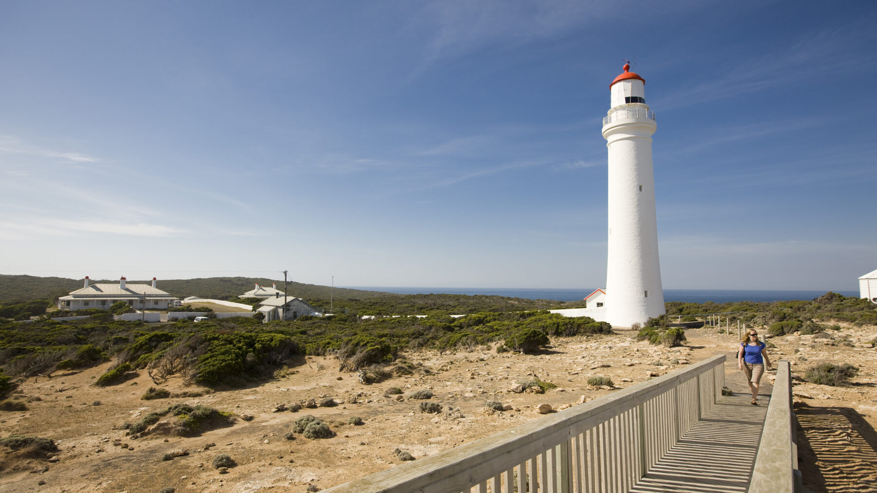
Cape Nelson is the only place in Victoria where short multi-trunked eucalypts known as soap mallee grow naturally. They co-exist here with a mix of other interesting plants, including moonah, drooping velvet bush and white correa. The barren cliffs of the storm-beaten cape are layered in bands of orange calcarenite and dark basalt, presenting breathtaking views. At the cape’s most southern point, the Cape Nelson Lighthouse stands 32m high. Made of local stone, its construction began in 1882 and it was first lit in 1884. It became automated in 1999.
On the eastern side of the cape, the Tuesday maintenance crew are busy working on a scenic part of the track called The Enchanted Forest. Wielding a brushcutter from side to side, John Legg slashes the vegetation that has closed in on the track. On our approach he switches the machine off and removes his earmuffs.
“Welcome, not a bad view from our office today,” he says with a smile. “It’s a spectacular piece of coastline, isn’t it!” John reveals that Bill enticed him to join Friends of the GSWW about 20 years ago when he retired. “I love the friendships, the camaraderie, the diverse environments, these amazing views, just being out in nature,” he says. “And I really enjoy the rehabilitation work we do. It’s all very rewarding.”
The writer and photographer were guests of Visit Victoria.
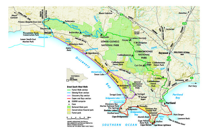
This 251km (beach route) or 262km (Mount Richmond route) loop track is located approximately 370km by road west of Melbourne and 540km by road south-east of Adelaide, in Victoria’s south-western corner. Portland is the most popular place to start and finish. The town was Victoria’s first permanent European settlement and contains more than 200 historic buildings classified by the National Trust, many of which are constructed from bluestone.
The GSWW is relatively flat, clearly marked and well maintained, making it suitable for all ages and levels of experience. Parts of the track can be experienced via short walks, day walks or longer multi-day walks.
The route contains 14 campsites, spaced 10-20km apart. Each campsite has a water supply, firepit, toilet and shelter. The water cannot be guaranteed safe for drinking, so walkers should know how to treat it to avoid illness. Firewood is scarce along the coast, so a gas or fuel stove should be carried.
Once or twice a year, Friends of the GSWW offer supported tours with an experienced guide, with a vehicle to transport packs between campsites.
Nature’s symphony
1. COBBOBOONEE FOREST WALK
Starting in the east, this section of the walk begins tamely and takes walkers through classic native eucalypt forest. The distance from Portland to Moleside is approximately 80km. The track is flat and even, with attractive valleys and river crossings. It explores the headwaters of the Surry and Fitzroy rivers, where ferns flourish in the gullies. Crimson rosellas in flashes of scarlet and deep blue flicker through the trees. Gang-gang cockatoos and cuckoos inhabit the trees during spring. Kangaroos and emus move freely through native wildflowers. This section is ideal for short walks, with excellent picnic facilities and vehicle access at Surry Ridge and Jackass Fern Gully.
2. GLENELG RIVER
The trees grow shorter and more rugged as the track approaches the banks of the mighty Glenelg River. The track winds alongside the river and then up along the rim of the towering gorge. It turns away from the gorge for brief stretches but always returns to the edge for the most spectacular lookouts imaginable. The river is tidal, and the estuary widens as it approaches the sea. The sound of waves sometimes echoes as far as 30km upstream. Many visitors combine canoeing and walking – it is one of the best canoe trips in Australia. The Glenelg is a river of international reputation, but sections of it can be enjoyed via a 10-minute or a 90-minute walk, starting from different car parks. Wildlife is in abundance and includes platypus, ducks, moorhens, emus, kangaroos, wallabies, possums, koalas, wombats and kingfishers. More than 700 species of native plant bloom in the bush, including dozens of species of wildflowers.
Loop walks are popular at Battersbys and Pritchards camping and picnic grounds.
Things to do and see
• Hire a canoe and paddle along the Glenelg River.
• Pitch a tent and camp on the riverbank (permits required for sites that have vehicular access and are numbered, but not for the walkers’ campsites). Refer to the official GSWW map (see box opposite).
• Take a boat cruise through the spectacular limestone gorge, with cliffs of up to 50m.
• Visit the Princess Margaret Rose Cave for a close look at limestone formations, stalactites, stalagmites and helictites.
• Visit the tiny township of Nelson, on the banks of the Glenelg River.
• Fish the famous river estuary, rated as one of Australia’s favourite spots to catch a range of tasty species (fishing licence required; some exemptions apply including under 18 and 70 years of age and over).
3. DISCOVERY BAY
The third section of the walk is wild and exposed. Few beaches in Australia run for 55km on open sand facing such gigantic surf as that of Discovery Bay. There are huge mobile dunes around Swan Lake and beautiful deep water just inland at Lake Mombeong. The track allows walkers to leave the beach in sections, but it is the 55km beach and the wild ocean that exhilarate every visitor who dares to tackle these isolated shores.
It’s best to make your way along the beach section at low tide, rather than negotiate the soft sand above the high-
tide waterline.
BEWARE – swimming anywhere along Discovery Bay is inadvisable, because of dangerous rips and strong undertows that can carry even strong and experienced swimmers out to sea. Take insect repellent.
4. CAPES AND BAYS
Cape Bridgewater has some of the highest coastal cliffs in Victoria and protects a bay that stretches in a perfect crescent around the rim of a huge ancient volcano crater. One of the most popular walks around the area takes visitors to a lookout on the tip of the cape and to a platform above a seal colony. You may choose to take a closer look by boat, which leaves from the jetty along from the beach. Cable-reinforced suspended lookouts offer breathtaking views over aquamarine coves towards Cape Nelson. Another section of the walk visits the Enchanted Forest in a landslip, halfway down a cliff, where haunting moonah trees are draped by curtains of falling vines. Point Danger is the site of the only Australasian gannet colony on the mainland. Blue and southern right whales can be observed, while seals and dolphins are abundant around the capes.
Things to do and see
• Swim and surf at Cape Bridgewater.
• Take a tour of the Cape Nelson Lighthouse.
• Take a seal boat tour alongside rock platforms and into the mouth of a watery cave where you can watch up to 650 fur seals swim and dive off rocks.
• Don’t miss the freshwater Bridgewater Lakes, where you can enjoy a picnic or canoe in peaceful surroundings.
• Ride the Portland Cable Tram for a picturesque foreshore journey.
-This information has been reproduced courtesy Friends of the GSWW

The Great South West Walk: a guidebook to Victoria’s best long-distance hike
The Friends of the GSWW have produced a pocket-friendly reference book for those intending to complete the whole track, sections or day walks. It’s packed with all the information that will help you make this an unforgettable experience. Costing $34.95, plus postage, the book is a perfect companion for any first-time walker. Available from the GSSW website.
Credit: Source link


