Outdoor writer and photographer Corbet Deary is featured regularly in The Sentinel-Record. Today, Deary takes readers on a scenic excursion through southwest Arkansas.
Well, the daytime air is stifling, the ticks and chiggers are on the prowl and the pandemic doesn’t seem to be losing its grip. That being said, I decided to go with yet another scenic drive for this week’s article.
Fortunately, we are blessed with miles upon miles of roadways leading us through beautiful scenery. And the journey I chose for this particular article certainly makes its way through a landscape where one can enjoy the wonderful outdoors from the comfort and shelter of their vehicles.
We’ll begin at Hot Springs and head west on Highway 70. Traveling in the neighborhood of 33 miles to Glenwood, we will continue straight on the highway for another 9.5 miles to Kirby. At Kirby, we will leave Highway 70 behind and continue straight on Highway 27 and travel about 15 miles to Murfreesboro.
Although the highlights of the excursion begin at Murfreesboro, the drive up to this point has likely proven pleasant as well, as the highway makes its way through a quaint, rural setting, alongside several farms and even crosses the Caddo River.
This might also prove a good time to suggest stopping at one of these two quaint towns for fuel or to grab a bite. There will be no stores along the upcoming loop until we return to Murfreesboro.
Upon entering Murfreesboro, remain straight on Highway 19, where 27 makes a hard turn to the left. Continue straight for a tenth of a mile and take a right at the intersection to remain on 19.
Although the route I will be covering will remain straight along this highway for a ways, those who are interested in getting better acquainted with the Little Missouri River might take a detour to the left at 2.3 miles and follow the road a short distance to the Old Factory Site Access.
Continuing on Highway 19, for 2 more miles, another road on the left will lead to another access point of the river. And yet another road leading to an access point will be on the left four-tenths of a mile farther down the road.
All three of these access points are spots where one might consider casting a fly, as the Lake Greeson tailwaters are renowned as a reputable trout fishery. But even those who are not interested in fishing might find these stops worthy of a visit, as this particular river cuts its way through a beautiful setting.
Continuing on Highway 19 for 1.3 more miles, we will make our way to the entrance of the Riverside recreation areas. Although I have visited the aforementioned access points throughout the years, this is the spot that has beckoned my return time and time again.
I am a far cry from what one would consider as an accomplished fly fisherman. In fact, my casting technique has been compared to someone killing a snake with a keen stick. But I still enjoy fly fishing for trout from time to time. And the stretch of water running alongside the recreation area is where I always go.
Again, even those who do not fish might consider stopping at this spot, for several reasons. First and foremost, the scenery is beautiful. Let alone the fact that a restroom is also located on the premises. And those with children might want to stop and let them burn off a little steam on the playground equipment.
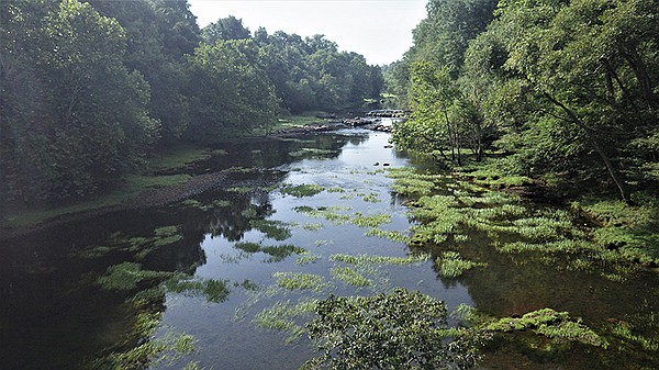
From the recreation area, the road will continue straight for a short distance, prior to making a sharp left and crossing a bridge just below the dam. Of course, stopping on the bridge is not recommended. But the views, both up and down the river are nice.
Glancing downstream, one can get a perspective of the section of water that we just visited at the recreation area. And the view upstream — one can get a birds-eye view of the large concrete structure containing Lake Greeson.
After crossing the bridge, the road will make an abrupt turn to the left. The road will make a slight ascent for the next nine-tenths of a mile to a parking area on the right. This is another stop which I would suggest, as one can see for miles from the vista. In fact, this is a great spot where one can get a nice perspective of a distant Lake Greeson.
The road leading to the Parker Creek Recreation Area will be located 1.4 miles farther into the drive. I had never visited this particular recreation area until our recent excursion, and I was impressed. The camping area is nestled in a pocket and provides folks with a peaceful setting.
Restrooms are located within the perimeters of the park, as is a launching ramp. And judging from the amount of people who were recently utilizing the recreation area, it’s a popular destination.
Continuing along the road, it makes its way alongside a few homes and transforms into an unsurfaced road top three-tenths of a mile past the road leading to the recreation area.
Continuing along the dirt road, we’ll arrive at an intersection in four-tenths of a mile, where we will take a left and make our way through a section of the Lake Greeson Wildlife Management Area.
The next 5.8 miles of the excursion will continue along a dirt road. However, the route is well maintained, and can easily be traveled. The road will continue alongside clearcuts and wooded sections of land for the next 5 miles.
I noticed several wildflower species taking root during our most recent excursion. And we also had the opportunity to stop and watch a whitetail doe and her fawns going about their everyday rituals in their natural environment.
The dirt road eventually meanders alongside a few private residences prior to arriving at the Highway 19 intersection, where we will take a left, and enjoy pavement for the remainder of the journey.
The highway makes its way across a bridge spanning the Little Missouri River soon thereafter, lending to yet one more view of this pristine waterway which begins in the mountains of Howard County.
Traveling 1.2 miles beyond the bridge, the road makes its way alongside Murfreesboro City Park. Although we did not stop at this facility, it appeared to be very well maintained. And I would suspect that this would prove yet another spot one’s youngsters might enjoy, after being cooped up in the vehicle for a while.
In fact, this might also prove a great location where the entire family might want to get out and stretch their legs. This might even prove a great spot to embark upon a picnic.
The road will return to Highway 27, at Murfreesboro a short distance after running alongside the park, where we will simply backtrack to Hot Springs.
I’ll be the first to agree that the summertime heat and the pandemic have put somewhat of a damper on the outdoor activities that we might choose at present. But we are still blessed in the sense that there are activities that we can enjoy safely and comfortably. And the aforementioned route is something that we might consider, upon our next urge to get just a little better acquainted with this state’s greatest natural resource — the wonderful outdoors.
One can catch a good view of a distant Lake Greeson shortly after driving across the bridge spanning the Little Missouri River just below the dam. – Photo by Corbet Deary of The Sentinel-Record
Credit: Source link


