Special to the Daily
Can you show me some good spots to catch fish?
This is one of the top questions that I am asked on a daily basis. We are lucky enough to live in an area that has a good amount of public access to the local rivers, however there are many areas that are privately owned and not accessible to fish. There are some great mapping services and resources to find out where to go and where not to be.
Our Laws are Different
In Colorado, there are many landowners whose land reaches into the river and by law they own that section/piece of the river bed. Anglers are not able to access these sections of river, unlike in states such as Montana where anglers can access the river through the highwater mark. When the rivers are high enough to float, without touching bottom/rocks, anglers gain access via boats, but landowners keep close tabs on these floaters. Anchoring, touching rocks with oars, and getting out of the boat on private sections is considered trespassing.
Also, in Colorado the landowners are not required to post where their land starts and ends, it is up to the angler to know these boundaries. This is where a good mapping service or the knowledge of locals comes into play.
Local Knowledge
Learning about great fishing spots takes time and getting out there and exploring. However, many people who visit our area do not have the time or ability to scout every section of a river. This leads many people into the local fly shops asking for “expert” advice. Fly shops are typically happy to extend some local knowledge in exchange for the purchase of some gear or a selection of local flies. While this local knowledge is a great starting point, it is very important to know where the property lines are and to respect them.
Google Earth
Google Earth is a great tool for e-scouting a new stream or river before heading out. The high quality satellite images that can be analysed and dissected so you can feel more comfortable when you put boots in the river. It’s also a great way to find boat ramps and how to access them. However, like local knowledge, Google Earth does not show property lines or public lands.
OnX Maps
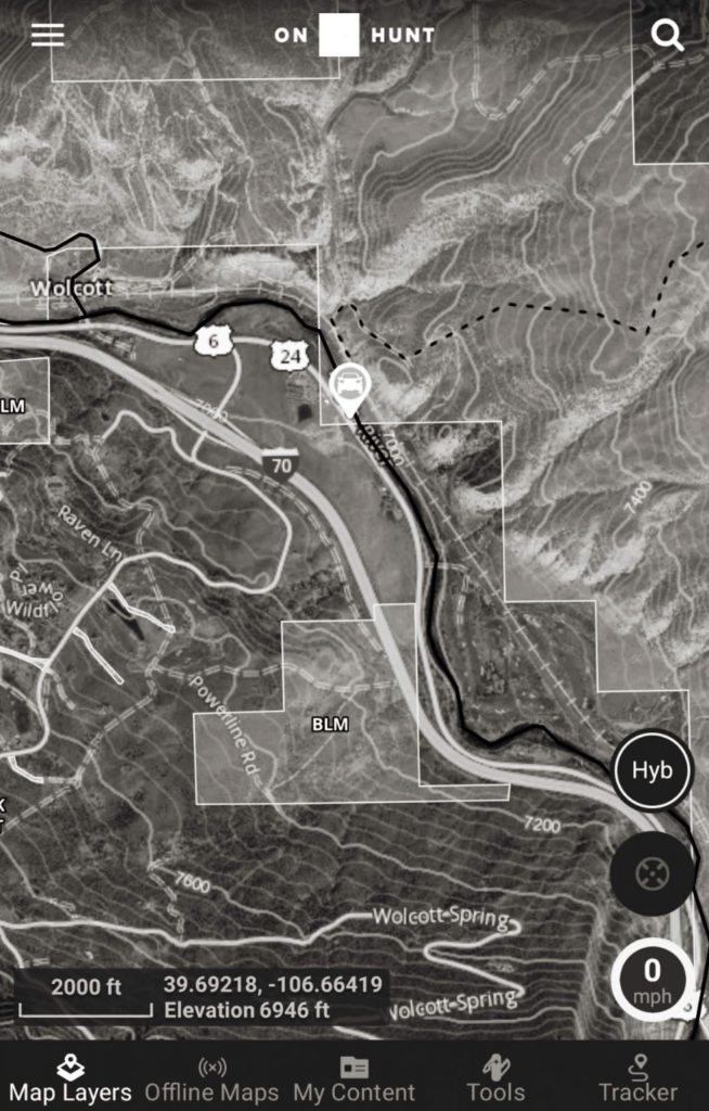
OnX Maps is a downloadable app for smartphones and also can be accessed through your computer. This is the ultimate e-scouting tool coupled with the ability to track you through GPS so you know exactly where you stand. There are multiple layers that can be turned on and off when you need to see who owns what. This is the most accurate way to know where the landowner boundaries are located and to avoid any trespassing.
One of my favorite features of OnX is the capability of marking waypoints on the map. I like to mark spots on the river where I catch fish and then I can make notes within the waypoints, such as weather conditions, flies used, time of day. I also really appreciate being able to download sections of maps to my phone for when I am exploring “off the grid”. The phone’s GPS will still track where you are even if you are out of cell range. While OnX is $30 a year for a specific state, the benefits are huge for those that enjoy exploring.
As you can tell there are many options to figure out new fishing spots. It is very important to know where you are in Colorado due to the “know before you go” rules when it comes to trespassing. Fly shops can show you some great spots but if you want to find some less known areas, a quality digital mapping service is going to be well worth the money spent.
Get out there and explore.
Ray Kyle is the Guide Coordinator and Guide at Vail Valley Anglers. He can be reached at (970)926-0900 or rkyle@vailvalleyanglers.com
Credit: Source link


