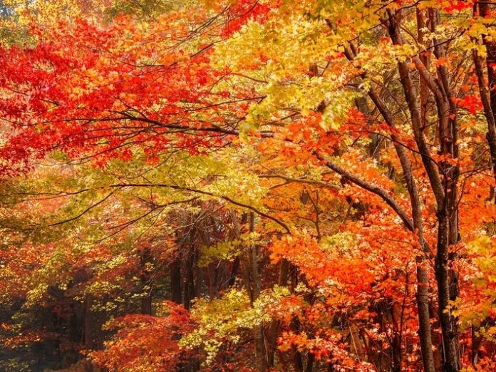
GEORGIA — The first day of fall is still weeks away, but the autumnal equinox isn’t the best measure of when foliage will turn to blazing reds, vibrant oranges and sunny yellows in Georgia. And hiking or taking a drive to view Mother Nature’s fall show is a great and safe way to get out of the house during the coronavirus pandemic.
No predictive tool is 100 percent accurate, but using the newly released interactive “2020 Fall Foliage Prediction Map” can help you plan excursions to see autumn leaves at the peak of their splendor.
In north Georgia, the week of Oct. 26 looks good for a trip into the great outdoors, while the week of Nov. 2 is optimum leaf-color time for the rest of the state.
Developed as a tool to help vacationers book lodging and other accommodations in the Smoky Mountains, which rise above the Tennessee-North Carolina border, the Fall Foliage Prediction Map from SmokyMountains.com provides peak leaf change predictions for the entire continental United States.
To use the map, simply slide the scale to the right to see when leaves will peak in your state. Zero in on your county, and you’ll be able to decide whether it’s best to plan a northern, southern, eastern or western route.
The Peach State offers some stunning vistas with hikes and trails to get into nature, including these state parks suggested by the Georgia State Parks website:
- Amicalola Falls State Park & Lodge — Dawsonville: Just an hour north of Atlanta you’ll find the Southeast’s tallest cascading waterfall.
- Black Rock Mountain State Park — Clayton: At an altitude of 3,640 feet, Black Rock Mountain is Georgia’s highest state park. Roadside overlooks and the summit Visitor Center offer sweeping views of the Blue Ridge Mountains.
- Cloudland Canyon State Park — Near Chattanooga: A favorite hike takes you down a staircase to the bottom of the canyon, where you’ll find two waterfalls.
- F.D. Roosevelt State Park — Pine Mountain: Many people are surprised to find hardwood forests and rolling mountains south of Atlanta. For a touch of history, drive to Dowdell’s Knob to see a life-size bronze sculpture of President Franklin Roosevelt and views of the forested valley.
- Fort Mountain State Park — Chatsworth: This park is best known for a mysterious rock wall along the mountain top, plus a variety of trails. For the easiest walk, take the 1.2-mile loop around the park’s green lake.
- Moccasin Creek State Park — Lake Burton: Georgia’s smallest state park sits on the shore of a deep-green lake. Guests can choose from the 2-mile Hemlock Falls Trail or 1-mile Non-Game Trail with a wildlife observation tower.
- Smithgall Woods State Park — Helen: Protecting more than 6,000 acres around Dukes Creek, this is the perfect spot for fly fishing while enjoying fall color. Day visitors can picnic near the creek, and overnight guests can hike a private trail to Dukes Creek Falls.
- Tallulah Gorge State Park — Near Clayton: Find one of the most spectacular canyons in the Southeast, and choose from easy or difficult trails. Hike along the rim to several overlooks with waterfall views, or get a permit from the park office to trek all the way to the bottom.
- Unicoi State Park & Lodge — Helen: New ziplines take you high above the forest canopy for a unique view of leaves.
- Vogel State Park — Blairsville: The 4-mile Bear Hair Gap Trail makes a nice day trip for experienced hikers, offering a birds-eye view of the park’s lake. For an easier walk, follow the Lake Loop to a small waterfall below the dam.
- George L. Smith State Park — Twin City: Join Mill Pond Kayak for a guided paddle trip under Spanish moss and tupelo trees. Photographers will appreciate exploring a covered bridge built in 1880.
- James H. Floyd State Park — Summerville: This quiet park in northwest Georgia has five miles of hiking trails, plus access to the 60-mile Pinhoti Trail.
- Victoria Bryant State Park — Royston: Located just minutes from I-85 in north Georgia, this little known gem has eight miles of hiking trails, a pretty stream and small fishing ponds.
The major factors that determine the fall foliage peak are sunlight, precipitation, soil moisture and temperature. The map takes in 50,000 predictive data sets, then churns out a county-by-county analysis of when the fall peak will occur, according to SmokyMountains.com co-founder David Angotti, an expert on statistics.
Angotti said improvements in algorithms used in the map combined with meteorological data sources have improved the reliability of the map, though he cautioned accurate meteorological predictions are “somewhat elusive and never 100 percent accurate.”
A new map is created every year due to dramatic changes from one year to the next, the release said.
What Causes The Different Colors
You probably remember from science class that the color change all starts with photosynthesis. Leaves constantly churn out chlorophyll — a key component in a plant’s ability to turn sunlight into the glucose it needs to thrive — from spring through early fall. Those cells saturate the leaves, making them appear green to the human eye.
But leaves aren’t green at all. Autumn is the time for leaves’ big reveal: their true color, unveiled as chlorophyll production grinds to a halt. The colors in fall’s breathtaking tapestry are influenced by other compounds, according to the national park’s website.
Beta carotene, the same pigment that makes carrots orange, reflects the yellow and red light from the sun and gives leaves an orange hue.
The production of anthocyanin, which gives leaves their vivid red color, ramps up in the fall, protecting and prolonging the leaf’s life on a tree throughout autumn.
And those yellows that make you feel as if you’re walking in a ray of sunshine?
They’re produced by flavonol, which is part of the flavonoid protein family. It’s always present in leaves but doesn’t show itself until chlorophyll production begins to slow.
Credit: Source link


