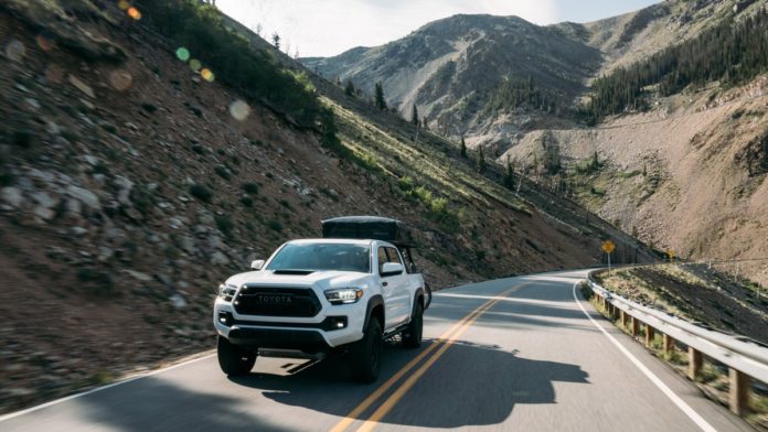
With 14,000-foot peaks and unreal desert landscapes for miles on end, it’s no secret that the mountain region of the U.S. has a lifetime of mountains, canyons, and backcountry roads to explore. So where to start? Read on for six of our favorites.
Discover The Most Scenic Byways in the U.S.
From winding canyon roads and vast desert straightaways to historic routes and serene oceanside drives, the U.S. is home to some of the most incredible roads in the world, including 184 official Scenic Byways. Here, we’ve compiled the best 25.
Find Your Byway
Secret Gateway to Yellowstone
Beartooth Highway: Montana — 69 miles — All-American Road
The highest highway in the Northern Rockies is the coolest gateway to Yellowstone National Park. As it takes you up and over Beartooth Pass and down some 7,000 feet through pine forests and alpine meadows into the wild northeast corner of the park, it puts you beneath 12,000-foot summits and leads to side canyons that harbor secluded hike-in fly-fishing lakes and mountain-bike rides. Intrepid skiers make use of those canyons for late-season (that is, summer) turns. In the park, you drive through the wildlife haven of Lamar Valley—wolf country—and you can hike Specimen Ridge Trail through a petrified forest to a glorious view of Mount Washburn and miles of meadows. Start (or finish) with a few days in the quintessentially Montana town of Red Lodge—ten blocks of brick facades and mountain friendliness, home to the historic Pollard Hotel.
Spires of Beauty
City of Rocks Backcountry Byway: Idaho — 49 miles — BLM Backcountry Byway
If you climb rocks, you’ve heard of and probably dreamed about City of Rocks, whose towering spires are a powerful draw: 600-plus climbs up to 600 feet on pocketed granite. But hikers, mountain bikers, and campers are equally drawn to this half-circle route that laces together the Albion Mountains, Pemerelle Ski Area, Castle Rocks State Park, and City of Rocks National Reserve before ending in amazing Oakley. This tiny burg teems with so many old stone and wood-framed buildings that the whole town is on the National Register of Historic Places. At City of Rocks, seek out Register Rock, etched with names and inscriptions from California Trail emigrants who passed through in the 19th century.
Red-Rock Ribbon
Scenic Byway 12: Utah — 124 miles — All-American Road
If you could choose just one road to explore Utah’s red-rock country, make it Scenic Byway 12. It connects the hoodoo-filled wonder that is Bryce Canyon National Park with the monumental geology of Capitol Reef National Park, and in between it runs through the even wilder, 1.9-million-acre Grand Staircase–Escalante National Monument. That means diversions galore, like partially paved Cottonwood Canyon, which runs through both Grand Staircase (don’t miss Grosvenor Arch) and Kodachrome Basin, with its cylindrical stone “sand pipes.” On the north side of 12, divert to Hell’s Backbone Scenic Byway—44 miles of red-rock wanders on gravel. Cool outdoorsy towns pop up just when you need a coffee or a burger: namely, Escalante, Boulder (famous for organic chow at Hells’ Backbone Grill), and Torrey. Bonus suggestion: Red Canyon has Bryce’s beauty without its people.
Two-Mile-High Byway
San Juan Skyway: Colorado — 233 miles — All-American Road
The mountain scenery is relentlessly stunning, and there’s everything to do along the way (bike, hike, fish, camp, explore native ruins and mining history). The aptly named San Juan Skyway ascends multiple passes higher than 10,000 feet as it loops through the San Juan Range, while fourteeners loom overhead. The route links iconic mountain-sports towns like Telluride, Durango, and Dolores, the latter perched between the cliff dwellings of Mesa Verde National Park and the vast Canyon of the Ancients National Monument. The stretch between Silverton and Ouray is known as the Million Dollar Highway, honoring the gold ore extracted thereabouts…as well as the cost of building such a canyon-clinging ribbon of road. Ouray is best known now for ice and rock climbing, while its old mining roads beg to be four-wheel-drive-tested.
460 Hairpins
Coronado Trail Scenic Byway: Arizona — 123 miles — National Scenic Byway
You’d be hard-pressed to find a less traveled (or more curvy) federal highway than U.S. 191’s run down the wild spine of eastern Arizona. In the course of 123 miles you’ll negotiate 460 hairpins as you plunge into cactus-dotted canyons and ascend cool passes in the White Mountains. For one 17-mile stretch, you skirt the limestone cliffs of the Mogollon Rim, the southern face of the Colorado Plateau. Spanish explorer Coronado followed this route in 1540 in search of the Seven Cities of Cibola, which he didn’t find, and even today the route is virtually uninhabited (plenty of campgrounds, though). Midway along is historic Hannagan Meadow Lodge, in the heart of Blue Range Primitive Area, laced by three rivers and abounding with aspens, oaks, and maples. Fish, bike, hike…then resume hairpinning your way through Arizona’s remotest terrain.
Gateway to the Old Southwest
Geronimo Trail Scenic Byway: New Mexico — 154 miles — National Scenic Byway
Quirky boom-and-bust mining towns, austere desert scenery, and the wooded mountains of the Gila National Forest are all part of this byway that loops through the varied terrain of southern New Mexico. The route is so dynamic that it has its own visitor center, located in the town of Truth or Consequences—famous for hot springs, and, well, its quirky name. On the byway’s northern leg, hike in the Aldo Leopold Wilderness and intersect with the Continental Divide National Scenic Trail. On the south leg, hit the old silver-mining town of Chloride, which bit the dust when the U.S. opted for gold rather than silver as its currency standard. More vibrant is the artsy town of Hillsboro, where the General Store is a must-stop café—order green chile with whatever you buy. Nearby Emory Pass is for peak baggers, and if you’re itching to put your four-wheel drive to work, try out tracks through the Caballo Mountains, just south of Caballo Lake State Park.
Click Here for More
Credit: Source link


