In the early 20th century, the patchwork of the United States was quilted together by almost 300,000 miles of railroad lines. When train transport fell into disuse in the 1950s and ’60s, a movement began to transform those abandoned industrial corridors into recreational space. Those miles of track had the potential to be ideal bike paths, thanks to limited incline and their proximity to towns which stood to benefit from a new kind of tourism.
There are many ways, and many steps needed, to turn a track with steel rails and spikes, wooden sleepers and stone ballast into a smooth, inviting bike route. But while the rails-to-trails movement started in the ‘60s, it got a major boost in 1986 with the development of the Rails-to-Trails Conservancy, a national organization that has helped local communities plan, fund-raise and execute their own trail development. Now, Rails-to-Trails is largely focused on connectivity — linking already existing trails (over 25,000 miles of them) to create bike networks that span the country, namely, the Great American Rail Trail, which will cross the country from Washington, D.C., to Washington state. Other long-distance projects include Peaks to Plains in Colorado, the Great Redwood Trail in Northern California, and the Route of the Badger in Wisconsin.
“We’re at a really exciting time in this country in terms of a never-before-seen understanding of the value of safe, outdoor activities,” said Ryan Chao, president of the Rails-to-Trails Conservancy.
One of the major benefits of the rails-to-trails movement is the sheer number of trails. Here are eight to get you started.
c
For an approachable, multiday ride through Northeast mountains
The Great Allegheny Passage connects Cumberland, Md., to Pittsburgh, passing around and through the Allegheny Mountains, the Laurel Highlands and 10 towns in Pennsylvania and Maryland. While its 150-mile span may sound daunting, the full through-ride offers ample opportunities to rest, eat, swim and sleep: There are bed-and-breakfasts, restaurants and ice cream shops in towns like Frostburg, Md., and Confluence, Penn.; campsites and shady spots in the mature forests of Ohiopyle State Park; and the Casselman, Youghiogheny and Monongahela rivers offer dips for tired toes and opportunities for kayaking, canoeing, rafting and fly fishing. Plan on spending three days and two nights on the full ride, or opt for a shorter journey. One one-day trip between Meyersdale and Rockwood, Penn., allows bikers to explore old railroad structures (like the Salisbury Viaduct, a destination for 360-degree views) or try an overnight ride from one trail town to another with an available shuttle service. (Amtrak’s Capitol Limited line also runs parallel to the route.) The trail is a stellar example of how prioritizing cycling infrastructure can be a boon to local communities — according to Bryan Perry, the executive director of the Great Allegheny Passage Conservancy, the trail created approximately $121 million in economic impact for the region in 2019 alone.
Number of miles: 150
Difficulty: Moderate; you’ll gain up to 1,700 feet in elevation, but the climb is gradual and smooth
Good for children: Yes, both the whole trail or shorter day trips and overnights
Don’t miss: Take in 360-degree views from the Salisbury Viaduct, which spans 1,908 feet across the Casselman River west of Meyersville, Penn.
Time to ride: Three days and two nights for the full ride, with ample options for day trips and overnights
Idaho
For easy windings through striking scenery
For a bike trail with gorgeous scenery, user-friendly terrain and approachable trail towns, seek out the Trail of the Coeur d’Alenes. The 73-mile route, parts of which are maintained by the Coeur d’Alene tribe and Idaho Parks and Recreation, runs between the towns of Plummer and Mullan, Idaho, and is fully paved — so cyclists of all levels (and with all kinds of bikes) can enjoy the ride. Winding through the striking mountains and valleys of the Idaho panhandle, the trail takes about two days to ride to completion, and that itinerary leaves ample time for stops like a meal at the Snake Pit in Enaville (the oldest restaurant in Idaho), swimming at Heyburn State Park and wildlife spotting along the Coeur d’Alene River. Riders looking to get a taste of the route with lakeside scenery and less distance should try riding from the town of Harrison to the Chatcolet Bridge, an enjoyable 8-mile jaunt.
Number of miles: 73 miles
Difficulty: Easy, mostly flat and entirely paved
Good for children: Yes, the trail is paved from one end to the other
Don’t miss: Fuel up at the Snake Pit, the oldest restaurant in Idaho, and stop for a photo at the official Center of the Universe in Wallace, Idaho
Time to ride: Two days
Wyoming
For a family-friendly taste of the wilderness
Biking between trail towns has its appeal, but there’s something to be said for a trail that feels like a proper wilderness ride. The Medicine Bow Rail Trail, a 21-mile gravel trail that cuts through the Medicine Bow-Routt National Forest in southern Wyoming, offers just that, in a rugged, forested landscape with frequent wildlife sightings. While the trail is decidedly remote — Laramie, Wyo., is the nearest big city and is 30 miles away — it’s still family-friendly, with little elevation gain and a generous width allowing parents to ride alongside their children. The area is rich with history, too — many native tribes, including the Arapaho and Cheyenne, frequently visited the area to conduct ceremonies, and parked at the trail’s northern end near Lake Owen (a worthy destination in its own right) are the remains of a train caboose from the track’s railroad past. Plan on the full ride one way taking around five to six hours, depending on how often you stop to look for moose, elk and other wildlife, and you’ll have to leave a car at each end — there is no shuttle service. Another hint: Bring plenty of water as there is none available on the trail (you’ll find restrooms and picnic tables, though).
Number of miles: 21
Difficulty: Easy to moderate, 688 feet of elevation gain total, but at high altitude
Good for children: Yes, the path is 10 feet wide so parents can ride alongside their children
Don’t miss: Check out Lake Owen, where you’ll find a footpath and the remains of an old railroad caboose
Time to ride: Five to six hours for a one-way ride
West Virginia
For a multiday bike-packing adventure through lush greenery
West Virginia’s Greenbrier River Trail strikes a fine balance between accessibility — it’s relatively flat and reachable at various points along its 78-mile length — and remoteness. The trail, which cruises downhill between the towns of Cass and Caldwell, runs alongside the Greenbrier River through lush West Virginia forest. This makes it an excellent bike-packing trail, with water, bathrooms, campgrounds and basic cabins available along the route, including at the Greenbrier and Seneca State Forests and Watoga State Park. The flat grade makes the trail accessible for children, too, whether you opt for shorter segments or the whole 78-mile, multiday journey. Since remoteness is a major part of this trail’s appeal (cell service is intermittent to nonexistent), creature comforts like fish tacos and a cold beer at the Dirtbean Cafe and Bike Shop in Marlinton are all the more appreciated. Be sure to stop for a photo at the curving, 230-foot Sharps Tunnel Bridge 10 miles north of Marlinton.
Number of miles: 78
Difficulty: Moderate, goes downhill at a one-percent grade
Good for children: Yes, the trail is largely flat and accessible for shorter sections
Don’t miss: The 230-foot Sharps Tunnel Bridge is a must-stop for a photo
Time to ride: Two to three days
California
For adrenaline-rush mountain biking on former mining trails and roads
The Downieville Downhill in Northern California — though consistently named one of the best mountain bike trails in the U.S. — is technically not a former railroad track. Instead, the trail is a part of the larger Lost Sierra Route, a work-in-progress trail network currently spanning 600 miles of decommissioned mining infrastructure that run through the Eastern Sierra Nevada, bringing biking and hiking tourism to former Gold Rush towns including Portola, Quincy, Susanville and, of course, Downieville. About 16 or 17 miles and a 5,000-foot drop through verdant evergreen forest, this route is not a beginner trail, but intermediate and advanced mountain bikers can expect a high-velocity adrenaline rush in one of the most beautiful parts of the country (shuttle services are highly recommended, and make it easy to get to the top of the trail for multiple rides, if you can’t get enough). The trail is also the anchor of the Downieville Classic, an annual mountain bike festival, race and fund-raiser that will be returning to the town and celebrating its 25th year in 2023.
Number of miles: 16 to 17
Difficulty: Intermediate to advanced; the trail drops more than 5,000 feet in about 16 miles
Good for children: No, unless they are little rippers
Don’t miss: The Downieville Classic, an annual mountain bike festival and race that will be celebrating its 25th anniversary in 2023
Travel Trends That Will Define 2022
Looking ahead. As governments across the world loosen coronavirus restrictions, the travel industry hopes this will be the year that travel comes roaring back. Here is what to expect:
Time to ride: Depends how fast you shred
Minnesota
For swimming stops galore
One of the first rail-to-trail conversions in the U.S., the Heartland State Trail is a largely flat, 49-mile trail that runs between Park Rapids and Cass Lake, Minn. Fittingly for the Land of 10,000 Lakes, the trail offers multiple, easily accessible spots for swimming and wading in lakes and rivers. In addition to city beaches alongside or near the trail in the towns of Park Rapids, Nevis and Walker, keep an eye out for places along the ride where steps have been built to allow riders to reach the river. Water isn’t the only attraction on this well-maintained, appealingly forested trail — you’ll want time to explore small yet bustling trail towns like Dorset, Minn., and stop for photos at the Paul Bunyan statue in Akeley. Experienced cyclists can certainly tackle the full 49 miles in one day, but those looking for a more leisurely (and kid-friendly) ride would do well to take a weekend, stop for a night in Dorset and leave plenty of time for swims.
Number of miles: 49
Difficulty: Easy, the trail is mostly flat
Good for children: Yes
Don’t miss: The Paul Bunyan statue in Akeley
Time to ride: One to two days
Arizona
For urban exploring amid desert landscapes
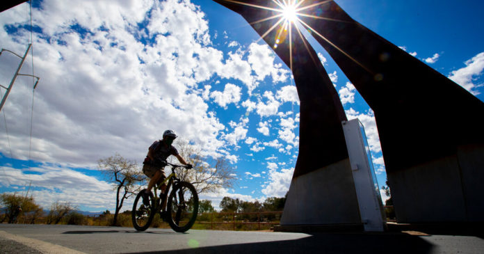
The Chuck Huckelberry Loop in Arizona, connecting unincorporated Pima County, Marana, Oro Valley, South Tucson and Tucson, is an example of newer urban infrastructure being reclaimed for recreation. After major floods in the 1970s and ’80s, Pima County constructed soil-cement bank protection along the Santa Cruz and Rillito Rivers, and noticed that residents were using the embankments as multiuse paths. Following their lead, the county began developing river parks with paved paths, connecting the river parks with neighborhood bike lanes and ultimately creating a full loop that was completed in 2018. The 137-mile paved loop includes a 68-mile circle around Tucson plus additional out-and-back rides along the banks of the Cañada del Oro Wash and Santa Cruz River, making for a unique combination of urban exploration — a Sunday farmers market in the Rillito River Park or a pit stop for coffee, beer and southwestern fare at downtown Tucson’s Mercado San Agustin near the Santa Cruz River Park — and striking desert landscapes with views of the Santa Catalina and Rincon Mountains.
Number of miles: 137
Difficulty: Easy; total elevation gain is about 1,000 feet, but the average gradient is one percent. There are short sections of up to 5 percent gradient at underpasses.
Good for children: Yes
Can’t miss: Check out Tucson’s Mercado San Augustín near the Santa Cruz River Park
Time to ride: One to three days for the full loop
Connecticut & Massachusetts
For a multigenerational history lesson
The history of the Farmington Canal Heritage Trail is immediately evident in its name — the largely flat trail runs alongside the former Farmington Canal, which was once used to transport agricultural products and manufactured goods on horse-towed boats. The canal, which ran from New Haven, Conn., to Northampton, Mass., was replaced by a railroad that was decommissioned in the 1980s. A local citizens’ group transformed a section of the corridor into a recreational trail in 1993, and over the decades added more miles with a roughly 81-mile connected trail now the goal. While some gaps still remain, the completed 64 miles provide a draw for cyclists of all ages. Learn more about the route with stops at the Lock 12 Historical Park in Cheshire, the Southington Train Depot in Southington and the Lock Keeper’s House in Hamden, where you’ll find a small exhibit on the canal’s history in a restored home. This year marks the 200th anniversary of the incorporation of the Farmington Canal Company and a number of events are happening through the summer and fall to celebrate, including a historical walking tour along the F.C.H.T. in New Haven on June 17.
Number of miles: 64
Difficulty: Easy, about 600 feet of total elevation gain
Good for children: Yes
Don’t miss: The Lock Keeper’s House in Hamden, Conn., which has a small exhibit on the canal’s history
Time to ride: One to three days
Credit: Source link


